
The Importance of Land Mapping in Renewable Energy Projects

Renewable energy is gaining momentum, increasing the demand for efficient land mapping. Understanding the significance of land mapping in energy ventures is crucial for maximizing progress and ensuring execution.
This article will delve into how thorough and accurate land mapping can help address challenges in choosing sites, planning projects, assessing impacts, and continually monitoring energy endeavors.
Choosing Sites: Locating the Ideal Location
Selecting the site is paramount when it comes to developing renewable energy projects. The financial feasibility of a project hinges on factors such as solar radiation levels, wind patterns, topography, accessibility, proximity to power transmission lines, and environmental considerations. Detailed land mapping plays a significant role in evaluating these factors.
By leveraging technologies like LiDAR (Light Detection and Ranging) or satellite imagery in conjunction with Geographic Information Systems (GIS) developers can gain insights into potential project locations.
These methods offer data on terrain characteristics like changes in elevation obstacles such as trees or structures that may impact wind flow or solar exposure slope gradients for assessing potential—essential elements that inform decision-making during the initial stages of site selection.
Additionally, incorporating weather data into land mapping systems can pinpoint areas with winds or ample sunlight year-round. By cross-referencing this information with socio-factors using spatial analysis tools in GIS, developers can mitigate risks associated with selecting locations.
Strategic Project Planning: Enhancing Design and Resource Evaluation
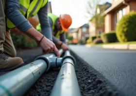
In the planning of energy initiatives, developers depend on land mapping to optimize design layouts and maximize resource utilization, such as positioning solar panels to capture sunlight efficiently or strategically siting wind turbines.
Utilizing terrain models created from elevation data collected during the land mapping process allows for calculations of shadow patterns at different times of day and seasons.
These calculations aid in determining the orientation angles for panels to avoid obstructions like hills or shadows cast by existing structures. In wind energy projects, understanding wind patterns and speeds helps determine the effective turbine layout while identifying potential areas of turbulence or noise disturbances impacting nearby communities.
To assess the resource capacity of a proposed site accurately, land mapping metadata should incorporate essential data points. For instance, soil analyses can assess ground stability for foundation placement and highlight erosion risks that could impact the project’s long-term sustainability. In addition, maps of the land can help us understand water features, like rivers and groundwater levels, for hydropower projects.
Assessing Environmental Impact: Reducing Harm to Nature
When it comes to energy initiatives, the focus is on minimizing the effects on our environment. Mapping the land is crucial in evaluating how a project might affect ecosystems and biodiversity before any construction work begins.
Sophisticated land mapping methods enable the analysis of vegetation. By using classification algorithms on satellite or aerial images, we can gain insights into accurately distinguishing between types of plants – whether it’s dense forests, vital wetlands supporting ecosystem health, or agricultural areas needing careful planning ahead of time.
By pinpointing regions before construction starts, we can implement effective measures to protect habitats efficiently. Combining data from land maps about resources (such as plant and animal distributions) with planning in Geographic Information Systems (GIS) developers can steer clear of environmentally fragile zones – preventing harm to protected species and important natural areas.
Monitoring Progress: Evaluating Project Performance
Once an energy project is up and running, ongoing monitoring plays a role in ensuring it functions at its best over time. Land mapping technologies help with assessments by providing data on changes in vegetation, soil erosion, degradation of solar panels (in solar farms), and the impact of structures on local wildlife.
A series of photos taken at different times show gradual changes in various aspects during the construction and growth phases of renewable energy projects, highlighting both positive and negative trends. These findings help maintain the projects by identifying issues and planning mitigation strategies proactively.
Conclusion
Increasing demand for energy-accurate land mapping plays a crucial role in project development and management. Precise mapping techniques assist stakeholders in making decisions regarding site selection and project planning while minimizing impact.
Continuous monitoring ensures performance and risk management throughout the project’s lifecycle. By utilizing technologies like LiDAR, satellite imagery, GIS systems, and data analysis tools, developers can make choices to propel clean energy initiatives forward.

Leave a Reply